東京工業大学地球史資料館
SiteMap English
展示案内
イベント案内
デジタルミュージアム(一般向け)
岩石試料の概要(学習者向け)
データベース(研究者向け)
リンク
ホーム
岩石試料の概要
世界の地質図 > グリーンランド > イスア > 説明文2

Geology of the Isua supracrustal belt

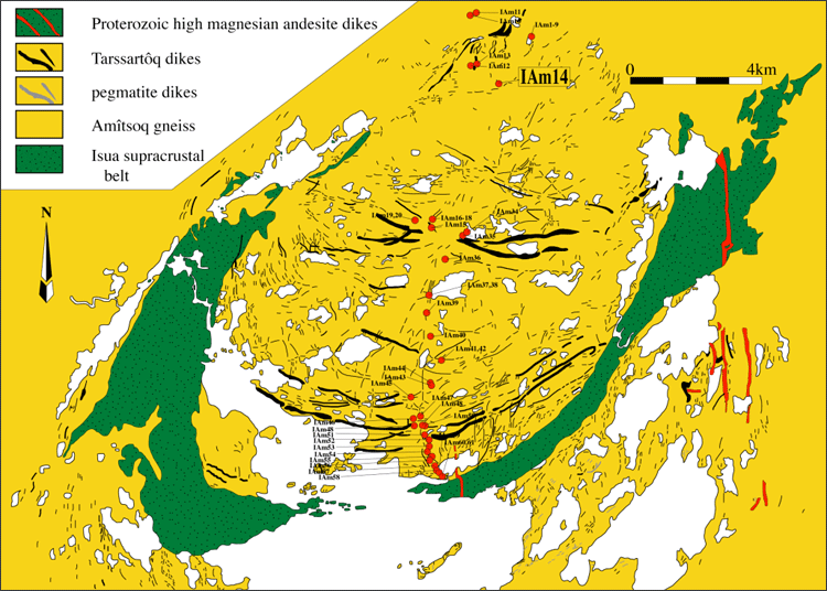
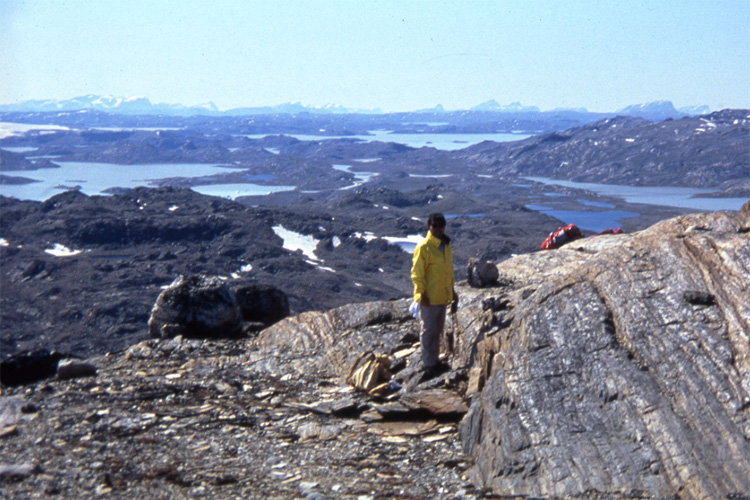
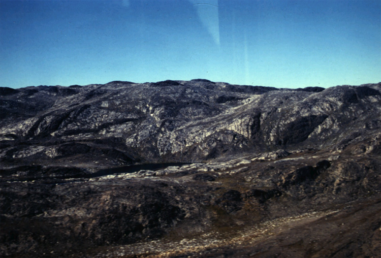
The Isua supracrustal belt lies approximately 150 km northeast of Nuuk, 
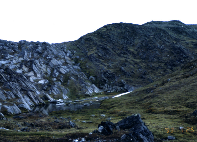
Greenland (Fig. 3). It forms arcuate tract (Fig. 5). The Isua belt is, 
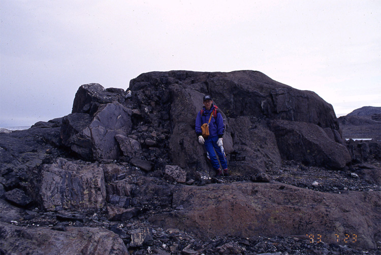
at present, exposed as a fault-bounded tectonic slice, and is in tectonic contact with the tonalitic Amitsoq orthogneiss on both sides (Fig.12) (McGregor, 1973; Bridgwater et al., 1974), but was originally formed as an enclave 
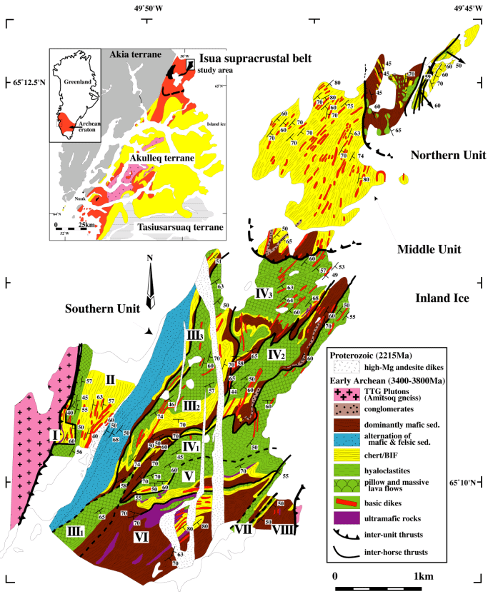
in the Amitsoq gneiss. The Isua belt comprises five Early Archean major 
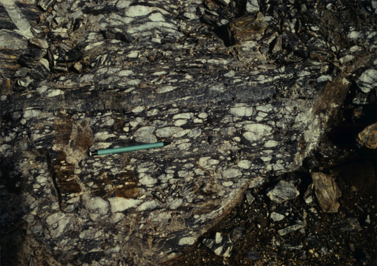
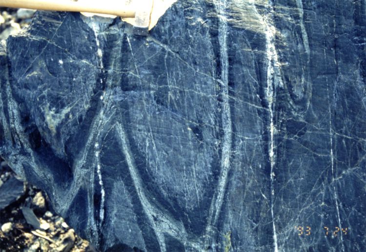
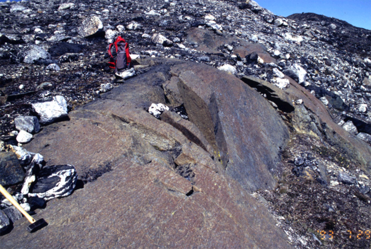
lithologic units: (1) a mafic-felsic turbidite sequence, including minor 
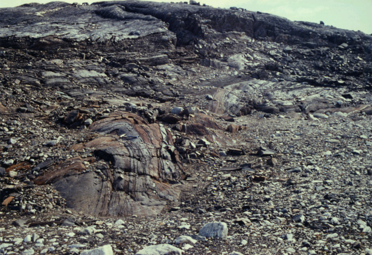
interbedded conglomerate (Fig. 6), (2) chert (Fig. 7a) and banded iron-formation 
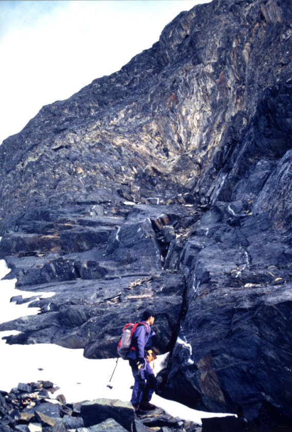
(Fig. 7b), (3) pillow lava (Fig. 8), massive lava, pillow breccia, and hyaloclastite, (4) dolerite-gabbro intrusives related to (3), and (5) ultramafic rocks (Fig. 9), plus mid-Archean and early Proterozoic intrusions (Fig. 10). The northeastern part of the Isua supracrustal belt is subdivided into three units, Northern, Middle, and Southern, by structural breaks defined by low-angle thrusts. The lower half of the Northern Unit is a highly disrupted melange (Type II, Cowan, 1985), with blocks of greenstone and chert. More than 37 angular to subrounded blocks of greenstone are randomly embedded in a highly sheared muddy matrix, together with several blocks of chert with or without BIF. The upper half is composed of more than four subunits bounded by layer-parallel thrusts. Each subunit is composed of pillow lava or sheet flow greenstone at the bottom, overlain by layered chert/BIF. BIF layers occur at the bottom of the sedimentary sequence, whereas white chert becomes more abundant through the transition of white/blue 
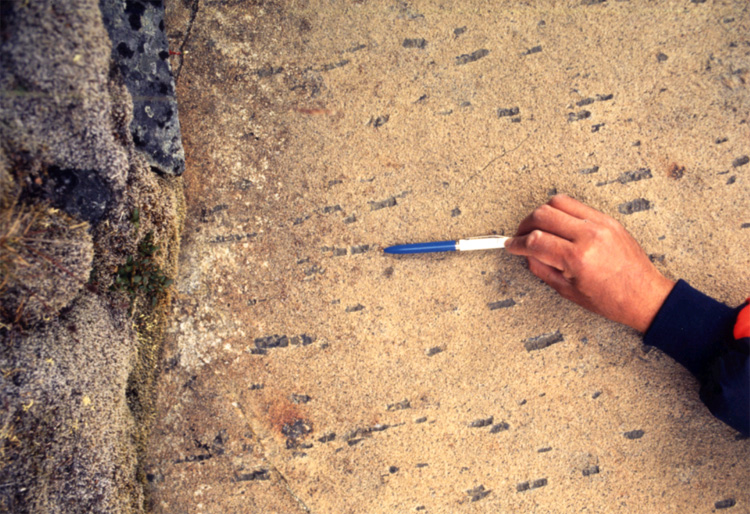
chert in the upper part. The Middle Unit is mainly composed of dominant NS-trending chert layers, and contains mafic turbidite sequence associated with felsic sandstone, mudstone, calcareous sandy shale (Fig. 11), and minor conglomerate near the southern margin.

Figure 4:The Isua supracrustal belt and the surrounding Amitsoq gneiss. Both were cut by Tarssartoq dykes, equivalent to 3.4 Ga Ameralik dykes (Fig 13). The geological evidence clearly shows the Isua supracrustal belt is older than the Ameralik dykes. In addition, U-Pb dating of zircons in the Amitsoq gneiss indicates that some of the Amitsoq gneiss are 3.8 Ga intrusions into the supracrustal belt.

Figure 5:Geologic map of the NE part of the Isua supracrustal belt. The inset is a geotectonic map of southern West Greenland, simplified after McGregor et al. (1991). Three terranes, Akia (gray), Tasiusarsuaq (gray with horizontal bars), and Akulleq are shown. Akulleq terrane is composed of Ikkattoq gneiss (yellow), Amitsoq gneiss (red), and supracrustal rocks (black). Post-collision Qorqut granite (pink) intrudes mainly Akulleq terrane. The Isua supracrustal belt is located in the northeastern corner.

Figure 6:conglomerate, interlayered with mafic terrigenous sediments

Figure 7a:Chert

Figure 7b:Banded iron formation in the northeastern part of the Isua supracrustal belt

Figure 8:The oldest basaltic pillow lavas in the Isua supracrustal belt. Some basalts preserve original pillow lava structure in this figure. Each pillow consists of core (green), mantle (darker green), rim (pale green to white colored) and matrix (darker green).

Figure 9a:Oriented large orthopyroxene crystals in peridotites

Figure 9b:A small peridotite massif, in the Isua supracrustal belt.

Figure 10:Proterozoic high magnesian andesite dyke with NS-trending, 2215 Ma

Figure 11:Chert (top of this photo), and terrigenous sediment sequence, of carbonate, mafic sediments, and conglomerate.

Figure 12:Fault boundary between the Amitsoq gneiss (left side) and the Isua supracrustal belt.

Figure 13:Amitsoq gneiss and 3.4 Ga Ameralik dykes with basaltic composition

 
TOKYOTECH